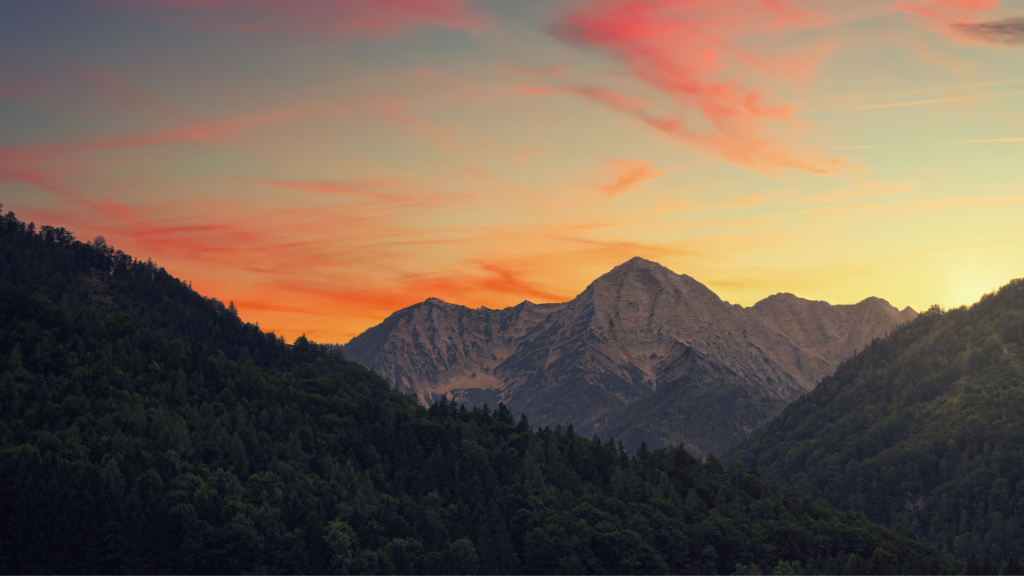
Nestled in Pakistan’s Punjab province, the Kirana Hills, often called the “Black Mountains,” are more than just a rocky landscape. Spanning about 68 square kilometers in Sargodha district, these hills are steeped in history, military significance, and natural beauty. Known for their dark, rugged terrain and peaks reaching up to 1,050 feet, they’ve long captured curiosity. From their geological roots to their role as a strategic defense site, the Kirana Hills hold a unique place in Pakistan’s story. Recent events, like India’s Operation Sindoor in May 2025, have sparked fresh interest, with rumors of nuclear facilities swirling. In this article, I’ll explore the hills’ history, features, military importance, and what makes them so intriguing. Let’s uncover the secrets of the Kirana Hills together!
The Geological Wonder of Kirana Hills
The Kirana Hills are a geological marvel, formed millions of years ago. Their dark, rocky appearance comes from hardened shales, slates, and traces of quartzites, with layers of hematite and rhyolites. British geologists studied them in 1913, noting their unique black rock formations, unlike nearby ranges like the Salt Range, 80 miles away. The hills stretch over 100 square miles, with an average height of 600 feet. In the 1970s, Pakistan’s Geological Survey found uranium deposits, leading to mining operations. The landscape is a mix of rocky steppe and grasslands, home to wild boars. Extreme weather, from 50°C summers to freezing winters, shapes this rugged terrain, making it both beautiful and harsh.
A Unique Rock Formation
The hills’ black rocks are what set them apart. Composed mainly of shales and slates, they contain hematite and thin bands of volcanic rhyolites. These rocks, studied extensively in 1913, give the hills their “Black Mountains” nickname. Unlike the Salt Range, their composition is distinct, with minor quartzites adding to their rugged charm. This unique geology makes the hills a fascinating site for scientists and adventurers alike.
Home to Uranium Deposits
In the 1970s, the Geological Survey of Pakistan discovered uranium ores in the Kirana Hills. This led to mining efforts, as uranium is key for nuclear energy and weapons. The discovery added a strategic layer to the hills’ importance, drawing attention from Pakistan’s defense sector. Though mining details are scarce, the uranium deposits cemented the hills’ role in Pakistan’s scientific and military landscape.
A Strategic Military Stronghold
The Kirana Hills are a key defense site for Pakistan, managed by the Ministry of Defense. Since the 1970s, the Pakistan Air Force has operated a radar station here, with Squadron No. 4091 still active. The hills are part of the Mushaf Airbase in Sargodha, just 20 km away. In the late 1970s, the Pakistan Army bored 46 tunnels, some up to 150 feet long, for potential nuclear tests. These fortified tunnels, built to withstand blasts, highlight the hills’ military significance. Though subcritical tests moved to Kala Chitta Range in the 1990s, the hills remain a strategic asset, fueling speculation about nuclear storage.
The Role of Tunnels
Between 1978 and 1979, the Pakistan Army Corps of Engineers dug 46 tunnels in the Kirana Hills, designed for nuclear testing. These tunnels, reinforced with concrete and iron rods, could handle blasts up to 40 kilotons. Built by the Special Development Works unit, they’re a testament to the hills’ strategic value. While no full-scale tests occurred here, the tunnels remain a key feature of the military setup.
Connection to Mushaf Airbase
The Kirana Hills are closely tied to the Mushaf Airbase, 20 km away in Sargodha. The airbase, home to F-16 jets, is a major Pakistan Air Force hub. The hills’ radar station monitors airspace, while their proximity to the airbase makes them a vital defense zone. This connection has sparked rumors of nuclear storage, especially after India’s strikes on Sargodha in May 2025 during Operation Sindoor.
Kirana Hills and Nuclear Rumors
The Kirana Hills have long been linked to Pakistan’s nuclear program. Reports suggest the hills were used for subcritical nuclear tests between 1983 and 1990. A 2023 Bulletin of the Atomic Scientists report called them a “subcritical test site” with 10 underground storage facilities. Social media buzzed in May 2025, claiming India’s Operation Sindoor hit nuclear sites here, but Air Marshal AK Bharti denied this, saying, “We did not hit Kirana Hills, whatever is there.” Despite denials, the hills’ fortified tunnels and proximity to Sargodha’s airbase keep nuclear speculation alive, though no hard evidence confirms active nuclear storage.
Operation Sindoor and Social Media Buzz
In May 2025, India’s Operation Sindoor targeted Pakistani airbases, including Sargodha, 20 km from Kirana Hills. Social media posts claimed India hit nuclear facilities, citing smoke near the hills. Videos and images fueled speculation, with some linking Pakistan’s earthquakes to alleged strikes. Indian officials, including Air Marshal Bharti, refuted these claims, stating the strikes focused on terror sites, not Kirana Hills.
Debunking Nuclear Strike Claims
Rumors of nuclear strikes on Kirana Hills grew after reports of a US B-350 AMS aircraft in Pakistan, supposedly checking for radiation leaks. However, experts clarified this was a Pakistani B-350, not a US plane. No satellite imagery or official reports confirm damage to nuclear sites. The hills’ nuclear role remains unproven, with Pakistan’s nuclear arsenal likely spread across multiple locations for security.
The Cultural and Historical Context
Before becoming a military zone, the Kirana Hills were home to a small village, later moved to Rabwah and Sargodha. Named after this village, the hills hold historical significance. British surveyors in 1913 mapped their peaks, while the 1970s uranium discovery marked a new chapter. The hills’ transformation into a defense site reflects Pakistan’s strategic needs. Despite their military role, parts opened for tourism in 1995, though access is now restricted due to security. The hills’ mix of history, geology, and modern defense makes them a symbol of Pakistan’s complex identity.
From Village to Military Zone
The Kirana Hills were once a quiet village area, with residents relocating to Rabwah and Sargodha as the region developed. The name “Kirana” comes from this village. By the 1970s, the Ministry of Defense took over, turning the hills into a restricted zone. This shift from rural life to a high-security site mirrors Pakistan’s growing military priorities during the Cold War era.
Tourism and Restricted Access
In 1995, Pakistan opened parts of the Kirana Hills for tourism after nuclear tests moved elsewhere. Visitors could explore the rugged landscape and grasslands. However, recent tensions and military activities have limited access. As of May 2025, the hills remain a military reservation, with the Pakistan Air Force’s radar station and security measures keeping most areas off-limits to the public.
Why Kirana Hills Matter Today
The Kirana Hills are more than a geological or military site—they’re a focal point of intrigue and strategy. Their role in Pakistan’s defense, from radar stations to rumored nuclear storage, underscores their importance. The 2025 India-Pakistan tensions, sparked by Operation Sindoor, brought them into the spotlight, with social media amplifying myths and mysteries. Yet, their natural beauty, with dark peaks and vast grasslands, remains a draw for those who dream of exploring them. The Kirana Hills symbolize Pakistan’s blend of history, security, and untamed wilderness, making them a captivating topic for anyone curious about the region.